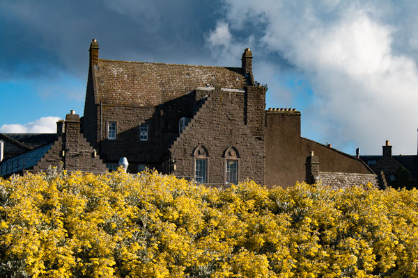
11.10.2017 Adrossan Marina
 Unsere Reise 2017 ist zu Ende. Unser Boot liegt sicher in Adrossan an Land. Ende Februar 2018 geht es weiter.
 Our sailing tour 2017 comes now to an end. The boat is safly stored in Adrossan. In 2018 we plan to start the season End of February.
01.10.2017 Crinan Kanal

Langsam geht unsere Reise für dieses Jahr zu Ende. Wir fahren nochmals durch den Crinan Kanal, da schon wieder Sturm angesagt ist und eine Fahrt um das Kap von Kintyre dann schwierig
wird. Es sind im Kanal fast keine Boote mehr unterwegs, so dass die Durchfahrt durch den Kanal eine beschauliche Reise in dem aufkommenden Herbst wird.
Our journey for this year is slowely coming to an end. Once again we sailed through the Crinan Canal as the weather forecast predicted strong winds and sailing around the Cape of
Kintyre would be too difficult. This time of year there are only a few boats in the canal so it turned out to be a quiet and peaceful passage this time.
22.09.2017 Äusseren Hebriden - Tobermory
Das Wetter meint es wirklich gut mit uns: nach einem Tag wechselhaftem und stürmischen Herbstwetter, scheint heute den ganzen Tag unserer Überfahrt von den Hebriden nach Tobermory die
Sonne. Am Anfang unter Motor, später unter dem Parasailor und zuletzt mit dem Großsegel und Genua, rauschen wir zurück zum schottischen Festland. Unterwegs erleben wir einmalige Begegnungen mit
vielen Delfinen und Walen. Mit unserer Kamera ist es uns gelungen die Delphine unter Wasser zu filmen. Kurz bevor es dunkel wird laufen wir in Tobermory ein. Die Marina füllt sich am nächsten
Morgen noch mit weiteren Booten - das nächste Sturmtief wird bereits erwartet.
Today we are really lucky with the weather: after yesterday’s rainy and stormy autumn weather, today is mostly sunny during our daytrip from the Outer Hebrides back to Tobermory close
to the Scottish mainland. After motoring in the beginning, we soon got some wind to put up our Parasailor and finally continued with the mainsail in combination with the Genoa. Throughout the day
we had many encounters with dolphins and whales. With our camera we were able to take a spectacular under water film of the dolphins. Shortly before it got dark we arrived in Tobermory. Currently
the marina is becoming more and more crowded with sailingboats, as the next deep pressure with storm is expected tomorrow morning already.
20.09.2017 Barra und Lochboisdale auf den Äusseren Hebriden


Unser Plan geht auf: Wir segeln weiter nach Westen zu den südlichen Inseln der Äußeren Hebriden. Mit starkem Nordwind brausen wir in den geschützten Hafen von Lochboisdale. Da der
Wetterbericht in den nächsten Tagen ruhiges und sonniges Wetter vorhersagt, fahren wir am nächsten Morgen weiter Richtung Süden auf die Südseite der Insel Barra. Überraschender Weise gibt es in
Castlebay einen Schwimmsteg, an dem wir festmachen. Eine Radtour um die Insel und die Besteigung des höchsten Berges der Insel stehen an. Auf Barra gibt es einen Flugplatz, der seine Landebahn
auf einem Sandstrand hat – gelandet und gestartet wird nur bei Ebbe. Vor dem nächsten Sturm fahren wir zurück in den sicheren Hafen von Lochboisdale.
Our plan which we made a few days ago in Stornoway works: today we sailed west to the southern islands of the Outer Hebrides. With a strong northern wind we enjoyed a fast sail to the
save harbor of Lochboisdale. As the weather report forecasts calm and settled weather for the next two days we decided to continue south to the Isle of Barra. We went on a cycle tour around the
island and a hike to the highest mountain of the island. There is a unique airport on Barra which uses the beach as a runway – only low tide allows landing and take off. Before the next storm
arrives we sailed back to the save harbour of Lochboisdale.
16.09.2017 Rum und Canna


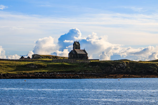


Da der Wind weiterhin entweder vom Norden oder vom Süden bläst, ist der Weg nach Westen zu den Inseln Rum und Canna sehr gut zu segeln. Beide Inseln zählen zu den kleineren Inseln in
Schottland und haben jeweils nur eine Handvoll Bewohner. Die Insel Rum ist sehr gebirgig und hat eine schöne Bucht zum Ankern - mit Schloss am Ende
der Bucht. Wir können in Rum einen ca. 400m hohen Berg besteigen, der Aufstieg wird mit einer tollen Aussicht zu den Inseln Sky und Canna belohnt. Die Weiterfahrt zur Insel Canna geht entlang der
Nordküste von Rum in, die nach Osten offene Bucht von Canna Harbour. Wir liegen an einer Mooring Boje und werden zwei Tage vom starken Nordwind durch geschüttelt. Dieses Mal sind gleich vier
Segelboot hier, alle warten, bis der Sturm vorbei ist. Am Abend haben wir im Cafe Canna ein tolles Abendessen und ein paar Bier und viel Spaß mit den anderen Crews.
As the wind continues to come from the north or from the south, we had a nice sail to the islands of Rum and Canna to the west. Both
islands are a part of the so called “Smaller Islands” of Scotland; they are inhabited by only handfuls of people. The island of Rum has lots of mountains and a nice bay for anchoring with a
castle at the end of the bay. On our second day in Rum we were able to climb one of the mountains which gave us a spectacular view to the islands of Sky and Canna. On our way to Canna we were
sailing along the north coast of Rum and then continued to Canna Harbour, which is open to the east. We were mooring on a boje and were facing a severe storm the upcoming days. As the bay has
some good protection four other sailors were also waiting for the storm to calm down. In the evening we had a great dinner with some beers in the café Canna and lots of fun with the other sailing
crews.
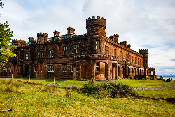
11.09.2017 Castle of Eilean Donnan


Das Wetter bleibt weiterhin sehr wechselhaft mit viel Wind und Regen. Von Plockton aus segeln wir durch die Brücke zur Insel Skye. Der Weiterweg führt uns wieder in den Kyle Rhea mit seinem starken Tidestrom. Da wir etwas zu früh am Eingang stehen segeln wir kurz entschlossen noch weiter die 4sm zum Eilean Donnan Castle. Das Schloss wird als d i e Sehenswürdigkeit in Schottland gehandelt, und obwohl es von der Straße aus mit vielen Bussen und PKWs dort oft sehr voll ist, haben wir von der See aus das Schloss für uns alleine. Zurück geht es zum Kyle Rhea und mit über 12kn Fahrt über Grund schießen wir mit Unterstützung des Tidenstroms durch die Engstelle. Die nächsten beiden Tage liegen wir im Dauerregen und Sturm an einer Mooring Boje in Duisdale bevor wir weiter nach Mallaig segeln.
The weather continued to be very unreliable with lots of wind and rain. From Plockton we continued sailing through the bridge to the Isle of Skye. As we still had some time for the tide to continue to Kyle Rhea, we decided spontaneously to sail the 4 nm to the castle of Eilean Donnan. The castle is one of the main tourist attractions in Scottland. As it is very busy with lots of buses and cars from the land side, we were the only boat watching the castle from the sea side. Sailing back we continued to speed down the Kyle Rhea supported by the tidal stream with over 12kn. Before we continued to Mallaig, we stayed due to lots of rain and storm two days on a mooring boje in Duisdale.
08.09.2017 Stornoway - Plockton


Eigentlich wollen wir die Äußeren Hebriden von Norden nach Süden
durchsegeln. Doch der starke Südwind lässt nicht locker, und gegen an segeln wollen wir auch nicht. Also nochmals ein Auto gemietet und ein paar Runden um die Insel gedreht, um die bei der ersten
Tour links liegen gelassenen Sehenswürdigkeiten zu bewundern. Auch auf dem 18 Loch Golfplatz von Stornoway spielen wir mit geliehenen Schlägern eine Runde. Schließlich geben wir das Warten
auf und segeln nach Südosten zum Schottischen „Festland” zum Loch Gairloch und weiter zum mondänen
Ferienort Plockton. Wir wollen es später zu den südlichen Inseln der Hebriden vom Osten her probieren.
Our plan was to sail the Outer hebrides from north to south. However, the strong south wind should continue the upcoming days. So we rented again a car and did some more lops around the island to visit the remaining places which we haven’t visited so far. One day we even managed to get some golf clubs and played the 18 hole golf course of Stornoway, which is walking distance from the marina. As the south wind still continued we finally changed our plans and sailed to the south east to the Scottish mainland to Loch Gairloch and Plockton. Later, once we are more south, we will try to sail to the Outer Hebrides back from the east.
29.08.2017 Stornoway, Äussere Hebriden


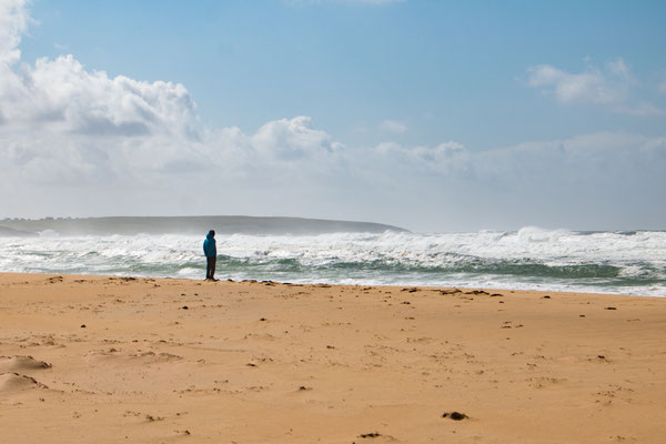


Der Wetterbericht sagt für den Nachmittag aufkommenden starken Wind bis Sturm vom Süden voraus. Wir beschließen daher sehr früh am Morgen zu starten um nach Stornoway zu den Äußeren
Hebriden zu segeln unterwegs begleiten uns eine Schule Delfine. Als wir um 14 Uhr nach 50 nm ankommen, hat der Wind bereits auf 35kn (60km/h) aufgefrischt. Die Marina in Stornoway ist von allen
Seiten sehr geschützt, und so können wir den Sturm in der kommenden Nacht beruhigt über uns hinweg brausen lassen.
Mit einem Mietwagen erkunden wir die Isle of Lewis. Vor allem an der Westküste drückt der Sturm hohe Wellen mit viel Gischt gegen die Felsenküste. Kein Wunder, soll doch der nördlichste Leuchtturm Lith Sgeir der windreichste Ort der Britischen Insel sein. Der Windrekord am Leuchtturm liegt bei 230km/h.
The weather forecast for the afternoon predicted strong winds from the south for the afternoon. Therefore we started very early in the morning to sail to Stornoway to the Outer
Hebrides. When we arrived there at 2:00 pm after 50nm sailing, the wind had already increased to 35kn. The marina of Stornoway is very good protected from winds in all directions, so we
slept the next night well, when the storm hid Stornoway.
The next day we explored the Isle of Lewis with a rented car. On the west coast the waves were spectacular high and broke with al lot of noise and spray on the rocky coastline. No wonder, as the lighthouse of Lith Sgeir is the point in UK with the highest wind speed. A wind velocity of more than 140mph was already measured.
26.08.2017 Isle of Skye


In Portree machen wir unser Boot Noe an einer Muringboje fest. Das Dinghi wird startbereit gemacht. Doch der Dinghimotor will nicht so recht. Sehr fachmännisch zerlegt Domi den Motor
und gibt ihm erst mal eine Generalreinigung. Nachdem dann auch der Benzinschlauch ersetzt ist, gibt der Motor jeden Widerstand auf und läuft wie neu. Wir erkunden die nächsten vier Tage die Isle
of Skye mit einem Mietwagen – und für uns etwas ungewohnt, mit gefühlten Millionen von Touristen. Da die Verbindungen von der Insel nach Edinburgh recht zeitraubend sind, bringen wir Bella und
Domi am letzten Tag ihres Urlaubs noch zum Bahnhof von Perth.
In Portree we fixed Noe on a mooring boje and prepared the dinghy for our transport ashore. However, the motor of the dinghy didn’t work as expected. Domi dismantled the motor very
professional and cleaned the whole machine carefully. After Isaella and Christine had to row ashore because the engine died and did not want to start again we found a small black part blocking
the hose for the petrol. We replaced the petrol hose and now the engine does its job better than ever. The next four days we explored the Island with a car and very unexpectedly for us, with
other thousand tourists at each point of interest. Because there is no quick public transport connection from Portree to Edinburgh, we drove Bella
and Domi on their last day of vacation, to the railway station of Perth.
21.08.2017 Tobermory - Mallaig - Kyle of Lochalsh


Endlich wird das Wetter schön. Von Tobermory segeln wir bei sehr gutem Wetter und wenig Wind weiter nach Mallaig. Kaum angekommen unternehmen wir eine ausgiebige Rundwanderung über die
Berge rund um Mallaig. Mit einem herrlichen Sonnenuntergang auf einem der Gipfel beschließen wir den Tag. Am nächsten Tag fahren wir erst gegen Mittag los, da uns die Tidenströmung durch die
Meeresenge Kyle Rhea nach Kyle of Lochalsh durchschieben soll. Die Tide nach Norden setzt erst gegen Mittag ein. Unsere Rechnung geht auf – unterstützt von 6kn Strömung schießen wir mit über 11kn
Fahrt durch die Enge. Wir liegen jetzt in Kyle of Lochalsh neben der Brücke zur Isle of Skye.
The weather is improving significantly. From Tobermory we sailed with only little wind but sunshine to Mallaig. In Mallaig we used the good weather conditions for a long hike through
the mountains behind the village. On the last peak we could watch a spectacular sun set. On the next day we only had to leave during lunch time, because we wanted to use the tide, which should
push us through the Kyle Rhea towards Kyle of Lochhalsh. Our calculation the day before was correct and we had a speed from above 11kn which were supported by a current of almost 6kn. We moored
Noe in the marina of Kyle of Lochalsh very close to the bridge to the Isle of Skye.
19.08.2017 Oban


Nachdem wir den Kanal verlassen haben, segeln wir nach Oban und weiter nach Tobermory. Das Wetter hat sich verschlechtert und es weht starker Wind mit Regenschauern in Böen bis Stärke
8BFt. Das gibt uns die Zeit die Whiskey Brennerei in Tobermory zu besuchen.
After leaving the canal we are sailing to Oban and Tobermory. The weather turned into a lot of rain showers and wind up to 8BFt. Therefore we decide to stay one day in Tobermory and
visit the local whiskey distillery.
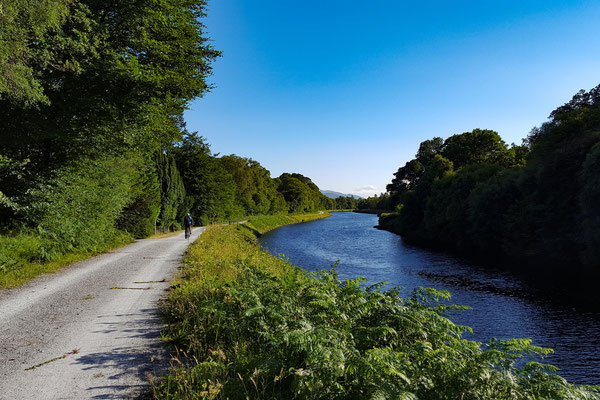
16.08.2017 Crinan Kanal


Nachdem es sich Bella und Domi an Bord gemütlich gemacht haben, sind wir wieder nach Norden gesegelt. Ziel war der Crinan Kanal, dann über Oban zur Insel Skye. Zunächst geht es mit
einem Zwischenstopp in Tarbert in den Crinan Kanal. Im Kanal gibt es 14 Schleusen. Die meisten der Schleusen müssen von der Bootscrew selbst geöffnet und geschlossen werden. Die Schleusentore
sind schwer und mit viel Kraftanstrengung zu bedienen. Das war dann ein willkommener work out für Bella und Domi. Der Kanal ist im Vergleich zum Kaledonischen Kanal sehr eng aber auch sehr
idyllisch. Er ist etwa 10sm lang und wird von uns mit vielen Pausen in drei Tagen durchfahren.
Very shortly after Bella and Domi came on board, we left Adrossan and are heading north. We plan to sail the Crinan Canal, passing Oban and sail to the Isle of Skye. First we sail with
a stopover in Tarbert to the Crinan Canal. The Canal has 14 locks, where most of them have to be operated by the boat crew. The gates are heavy and lots of man power is needed to open and close
them. It turned out to be the perfect work out for Bella and Domi. The Crinan Canal is compared to the Caledonian Canal very narrow but also very scenic. The canal is 10nm long and it took us
three days to pass, which included many stops along the canal.
08.08.2017 Mull of Kintyre - Adrossan


Heute stand die Umrundung des Mull of Kintyre auf dem Programm. Die Umrundung der Halbinsel war früher durch seine starke Meeresströmung sehr gefürchtet. Deswegen wurde um 1800 v. Chr. der Crinankanal gebaut, um Passagiere, Tiere und Waren sicher von Glasgow in den Norden Schottlands zu bringen. Heute, mit all
dem Wissen um Strömung, Wind und Wetter, ist eine gute Planung immer noch wichtig um eine reibungslose Umrundung des Mull zu gewährleisten. Unser Start war um 5 Uhr in der Früh, und mit bis zu
5kn Schub durch Strömung und 5kn Schub vom Wind kamen wir auf schnelle 10kn Geschwindigkeit über Grund. Ein anderes Segelboot startete erst um 11 Uhr und hatte deshalb die Strömung gegen an, so
dass trotz Motorunterstützung nur noch 2kn gegen den Strom übrig blieben. Zielort war Campbeltown. Von dort weiter ging es über Lamlash nach
Adrossan. In Adrossan wollen wir unser Boot über den Winter lassen. Doch zuvor begleiten uns Isabella und Dominik noch auf eine Reise durch den Crinankanal und weiter zur Insel Skye.
Today we planned to sail around the Mull of Kintyre. In former times this passage was very dangerous due to strong currents and unpredictable weather conditions. Therefore the
government built the Crinan Canal in AD 1800 to make sure of save travels for passengers, animals and goods from Glasgow to the north of Scotland. Nowadays good preparation is still important for
a save sail around the mull. We started at 5 o’clock in the morning and were pushed by the current with up to 5kn. Overall we got a speed of up to 10 kn thanks to the right wind direction. There
was a boat starting from the same location at only 11 o’clock. They had the 5 kn against them. Even with support of the engine, they managed an overall speed of 2 kn around the mull. Our
destination was Campbeltown. From there we continue the next days to Lamlash and to Androssan. We are planning on keeping our boat in Adrossan during the winter. But before we do so, Isabella and
Dominik are joining us for our way through the Crinan Canal to the Isle of Skye.
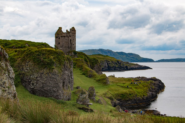
06.08.2017 Port Ellen


Es gibt drei Whisky Brennereien in Port Ellen. So wie es aussieht, sind wir jetzt im Zentrum der Whisky Produktion an der West Küste Schottlands. Von Oban war es ein hartes Stück
Arbeit, um bis nach Port Ellen zu kommen. Vor allem während der 51 sm von Groabh Haven nach Port Ellen, hatten wir mit starkem Wind und vielen Böen bis Windstärke 7 BFt zu kämpfen. Unser Plan war
eigentlich nur bis Craighouse zu segeln, aber durch den böigen Wind wollten wir die Einfahrt in die schmale Bucht in Craighouse nicht wagen.
There are three whisky distilleries in Port Ellen. It seems we are now in the centre of the Scottish whisky production area. It was tough getting from Oban to Port Ellen. During
the 51nm from Graobh Haven to Port Ellen we had strong winds with lots of gusts up to 7 BFt. Our plan was to
sail to Craighouse, but the winds were too strong for us to enter the small harbor and the mooring area, so we kept on going and ended up in Port Ellen.
03.08.2017 Oban, Kerrera Island


Vom Kaledonischen Kanal in Fort William fahren wir weiter nach Oban. Die Marina liegt gegenüber von Oban auf der Insel Kerrera. Mit einem Shuttle Service kommen wir von dort in die
Stadt. Auf Kerrera unternehmen wir eine Radtour, die uns über viele einfache Feldwege rund um die Insel führt. Bedingt durch den vielen Regen der vergangenen Tage, sind die Wege sehr matschig.
Highlight dieser Rundtour ist die Burg Gylen , die einsam und verfallen direkt am Meer auf einem Felsen steht.
From the Caledonian Canal in Fort William we continued onto Oban. The marina of Oban is situated on an island separated from the city. A regular shuttle service is provided from the
marina to the city. On the island Karrera we spent one day cycling on little paths around the island. Due to the heavy rain of the past couple of days, the paths are very muddy. The highlight of
our cycle tour was the castle of Gylen, which is a ruin situated on a rock very close to the sea.
26.07.2016 Ben Navis, Port William, Neptuns Staircase


Wir liegen jetzt vor Neptuns Staircase, dem westlichen Ende des Kaledonischen Kanals. Durch das Staircase, das aus acht Schleusen besteht, geht es
jetzt wieder nach unten auf Meereshöhe. Das Wetter war während den letzten Tagen hervorragend mit freiem Blick auf den Ben Nevis, dem höchsten Berg der Britischen Insel. Statistiken zufolge soll sich
der Berg neun von zehn Tagen in den Wolken verstecken. Da wir ihn die letzten zwei Tage gesehen haben, bleibt in diesem Monat also nur noch ein wolkenfreier Tag übrig. An einen Aufstieg auf den Ben
Navis war aber leider nicht zu denken, da sich Christine wieder mit einer hartnäckigen Erkältung plagt.
We are mooring in front of Neptuns Staircase, the western end of the Caledonian Canal. There are eight locks which will bring us back down to sea
level. The weather in the past few days was exceptionally nice. During the last two days we had a great view on Ben Nevis, the highest mountain of the British Islands. Statistically, Ben Navis is
covered with clouds in nine out of ten days, therefore there is only one day left during this month. Unfortunately, we did not get a chance to climb it, as Christine is suffering from another bad
cold.
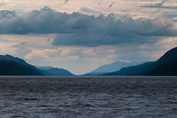
23.07.2017 Loch Ness


Am Ende des Loch Ness liegt der idyllische Ort Fort Augustus. Direkt im Ort geht es eine Schleusentreppe nach oben, bis der Kanal dann weiter in das Loch Oich führt. Neu war für uns,
dass es dort neben dem Nessy aus dem Loch Ness hier im Loch Oich ein Seeungeheuer mit dem Namen Lizzy gibt. Lizzy wird noch seltener als Nessy gesehen – wir hatten leider auch kein Glück. Dafür
gibt es für uns am Loch Oich alte Gemäuer zu bestaunen. Im Gengarry Castle, mit eigenem Anlegesteg, gab es dann in edlem aristokratischem Ambiente leckere Scones und Kaffee.
At the end of Loch Ness lies the small idyllic village Ford Augustus. In the center of the village there is a 'staircase' of locks which we climbed to get onto the level of Loch Oich.
Loch Oich is the home of the monster Lizzy, which is even less seen than Nessy - we didn’t have any luck either. Instead of watching out for Lizzy, we visited a few old buildings and castles
along the lake. Most impressing was the Gengarry Castle with its own pontoon. We had our afternoon coffee with scones in the castle in a very aristocratic atmosphere.
19.07.2017 Kaledonischer Kanal


In Inverness beginnt der Kaledonische Kanal, der die schottische Ostküste mit der Westküste verbindet. Er ist 60 sm lang und geht durch drei Seen. Der berühmteste See ist das
Loch Ness, das in ganzer Länge durchfahren werden muss. Nach der Registrierung und der Einfahrt in den Kanal geht es gleich durch eine Drehbrücke und mehreren Staustufen bergan. Dann schlängelt
sich der Kanal durch die Landschaft, bis man das 20 sm lange Loch Ness erreicht. Nessy war trotz intensiver Ausschau nicht zu sichten. Aber vielleicht hatten wir zu wenig Whiskey intus, und das
Wetter war wohl auch nicht schlecht genug um da irgendwo Nessy zu erahnen.
Inverness is where the Caledonien Canal, which conects the Scottish east coast with the west coast, starts. It is 60 nm long and leads through three lakes. The most famous lake
is Loch Ness, which has to be crossed from one end to the other. Just after the registration and the entrance in the canal, there is a swing bridge which is followed by a few weirs upwards. Now
we are already on the same level as the 20nm long Loch Ness. Despite the sharp look out which we kept during our crossing of Loch Ness, we didn’t see the famous monster. We were told that you
need to drink a few glasses of whiskey before you approach the Lake and the weather should be rainy and foggy to see the Monster.
15.07.2017 Inverness


In Inverness sind dieses Wochenende die Highland Games. Ein Höhepunkt im Kalender dieser Region. Hier messen sich die Einheimischen (und einige Auswärtige) im Tanzen schottischer Tänze,
im Dudelsack spielen und im sportlichen Mehrkampf. Hauptattraktion ist der Mehrkampf der Muskelprotze im Hammerwerfen, 25kg über eine Stange
schleudern, Baumstammwerfen und dann zum Abschluss eine 114kg Steinkugel über eine 5ft hohe Stange wuchten. Erst 8 Athleten ist es bisher in der Geschichte der Wettspiele gelungen diesen Stein
ohne Berührung über die Stange zu bringen. Dieses Mal hat ein Wettkämpfer aus Australien den Stein gleich zweimal drüber gewuchtet – einmal für den Wettkampf, und noch einmal um sich mit seinem
Handy filmen zu lassen. Morgen werden Sandsäcke über Stangen geworfen und Gewichte gestemmt. Dazu wird es wieder viel Dudelsack geben – es ist richtig schottisch hier.
This weekend there are the Highland Games in Inverness. It is a highlight of the annual event calendar of the region. Locals but also guests compete in Scottish dance, playing the
bagpipe and athletic competitions. However, the main attraction for many visitors is the competition in the Heavis Heavy event - throwing the Scots Hammer, Weight for Distance, Shot, Weight over
the bar, tossing the Caber and Inverness Stone are the exercises which have to be completed. The purpose of Inverness Stone is to lift and throw a 114kg heavy stone ball over a 5ft high bar,
without touching the bar. Only 8 athletes in history were successful managing this challenge. Today an athlete from Australia did the exercise twice – the first one was for the competition the
second one for his camera. During the whole event there were always musicians playing the bagpipe – indeed very Scottish.
11.07.2017 Kirkwall (Orkney Inseln) - Wick


Die Strecke von Kirkwall nach Wick, auf das schottische „Festland” hatte es in sich. Die Strömung und der Gezeitenhub müssen bei der Routenplanung berücksichtigt werden. Die
Abfahrtszeit und die gewählte Strecke muss sorgfältig ausgesucht werden, um nicht gegen eine Strömung mit den vielen Strudeln an zu fahren. Südlich der Orkney Inseln kann der Gezeitenstrom bis zu
11kn stark werden. Da kann man mit einem Boot, das 6kn fährt schnell die Kontrolle verlieren. Die Landschaften und Inseln werden flacher. Doch es
gibt vermehrt Burgen und alte Gebäude zu sehen.
The distance from Kirkwall to Wick on the Scottish mainland is demanding for sailors. The current and the tide need to be considered during the planning of the journey. The right timing
of the start and the way of sailing is essential to avoid sailing against the current and unexpected waves. South of the Orkney Islands the current can be up to 11kn strong, which can make a boat
with a speed of 6kn unmanageable. The scenery and the islands is getting more flat, however, there are more castles and old buildings of interest to see.
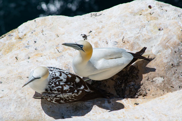
07.07.2017 Orkney Islands
Eine der Highlights auf den Orkneys ist sicherlich der Leuchtturm im Norden auf der Insel Westray mit seinen Vogelfelsen. Hier kommen ab April Basstölpel, verschiedene Möwenarten
Papageientaucher und andere Alkvögel her, um bis Ende Juli ihre Jungen auszubrüten und aufzuziehen. Dies ist besonders beeindruckend, wenn man sich
die steilen Klippen ansieht, wo die Eier zum Teil auf den nackten Felsen gelegt werden und die Vögel dem rauen Wetter von Westen das hier herrscht ausgesetzt sind.
One of the highlights of the Orkney Islands is definitely the light house in the north of Westray with its vertical cliffs below. Gannets, different kind of seagulls, Puffins and other
Aukbirds arrive here in April and stay mainly until end of July laying their eggs and raise their young chicks. It is very impressing to see the birds having their eggs partially on the bare
rocks of the steep cliffs which are exposed to the strong winds and bad weather coming from the west.


03.07.2017 Fair Isle


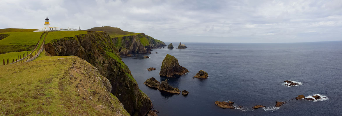


Fair
Isle entpuppt sich in der Routen Planung als der perfekte Zwischenstopp zu den Orkney Inseln, da die Insel genau zwischen Shetland und den Orkney Inseln liegt. Halb Naturschutzgebiet, halb
bewirtschaftet durch die etwa 70 Einwohnern ist Fair Isle eine faszinierende Vogelinsel. Ringsum sind steile Klippen und der anströmende Atlantik mit
seinem Fischreichtum ist für viele Vögel ein Paradies zur Aufzucht der Jungen. Fair Isle wird aber auch von den durchziehenden Vögeln als ein guter Halt auf dem Weg in den Norden benutzt. Bei den
Wanderungen liefen uns die Papageientaucher quasi zwischen den Füssen hindurch, Basstölpel und Sturmtaucher nutzen die Klippen zum Brüten und den Aufwind davor zu tollen Segelmanövern. Das lockt
auch eine ganze Menge an Ornithologen an. Im einzigen geschützten Hafen sind wir vier Boote, dicht gedrängt an einer kleinen Pier. Neben uns liegt Bob aus England mit dem Segelboot Tequilla und
seiner Crew. Bob, 74 Jahre alt, ist ein Segler vom alten Schlag. Bei einigen Drinks im Clubhaus der Vogelwarte werden die Vor- und Nachteile der Karten- bzw. der iPad Navigation ausgiebig
diskutiert – Bob hat bisher keinen elektronischen Plotter, nur Karte, Kompass und viel Wissen über die Navigation, da kommen wir uns ganz schön unwissend vor.
Fair Isle seemed to be the perfect stop over when sailing to the Orkney Islands, as it is situated in the middle between the Shetland Islands and the Orkney Islands. During our visit we
rated Fair Isle as one of the top Islands we have visited so far. Half of the island is protected as a national park whereas the other half is farmland with lots of sheep, maintained by its 70
inhabitants. Fair Isle is one of the best places to watch birds. In all directions there are steep cliffs and the permanent stream of the Atlantic Ocean, which allows many different kind of birds
to nest and settle. During a few hikes we got as close as an arm length to the puffins. We are only four boats in the north harbor, which is the only harbor of the island. Alongside of us there
is Bob with his sailing yacht Tequilla and his crew. Bob is 74 years old and a sailor since his childhood. During a few drinks in the clubhouse of the bird observatory we discussed intensively
the pros and cons of paper versus iPad Navigation – Bob has no electronic plotter on his boat, but maps, a compass and lots of knowledge about sailing.
26.06.2017 Shetland Islands


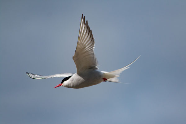


Wir sind bereits über eine Woche in Shetland und unser Plan ist von Lerwick die nächsten Wochen weiter nach Fair Island und dann nach Schottland zu segeln. Die Ureinwohner Shetlands
haben uns hier einen tollen Empfang bereitet. Puffins, Seeschwalben und viele verschiedene Möwen fliegen wie wild umher. Seehunde liegen an den
Küsten und sonnen sich. Shetland Ponys und viele Schafe sind auf den Weiden. Was auffällt: Bäume gibt es wegen des oft starken Windes auf den Shetland Inseln keine. Nur in windgeschützten Nischen
halten sich einige Sträucher. Und, es gibt wieder Seehund, die wir in Norwegen vermisst haben. Lerwick ist die Hauptstadt der Shetland Inseln und alle Straßen gehen hier zusammen. Hier pulst das
Leben. Immer wieder kommen Kreuzfahrschiffe an, wie heute ein Boot des National Geographic. Wir liegen geschützt im Haupthafen – erst an der Albert Wharf und dann im Small Boat Harbour. Unseren
Platz in der Albert Wharf haben wir gerne für die Boote der Segelwettfahrt von Bergen – Lerwick – Bergen geräumt, die mit fast 40 Segelbooten hier ankam. Der Hafen ist von fast allen Seiten
geschützt und er hat dies erst die letzten Tage bewiesen, als ein Sturm mit 70km/h über die Insel hinweg fegte. Es sind jetzt mehr Segelboote unterwegs als in unseren letzten Monaten in Norwegen.
Ein buntes Gemisch aus verschiedenen Ländern: Schweden, Norwegen, England, Polen, Frankreich, Niederlande, Belgien,…eine wahrlich Europäische Flotte. Neben uns liegen Lena und Bert mit ihrem
Segelboot „Heimkehr“ aus Hamburg. Sie sind wie wir Mitglied von Trans-Ocean und sehr erfahrene Segler. Wir verbringen gemeinsam viele schöne Stunden und erfahren von ihnen viel über das Segeln in
den Weltmeeren.
We are already more than a week in Shetland and our plan for the next weeks is to continue sailing to Fair Island and to Scotland. Puffins, black terns and many other seabirds gave us a
warm welcome to the islands. Seals are having a sun bath on the coast. Shetland ponies and thousands of sheep are here. However, compared to Norway, there are no trees in Shetland, because of the
permanent strong wind. Only in protected areas some small bushes are growing. And, there are seals again, which we missed so much in Norway. The
capital of the Shetland Islands is Lerwick where all roads meet. It is a very lively place. Lots of cruising ships stop here for a day. Today there
is the ship from National Geographic visiting the island. We are moored safely in the main harbor right beside the towncenter - first in the Albert Wharf and now in the small boat harbor. We left
our place in the Albert Wharf due to the arrival of more than 40 sailing yachts which were joining the race Bergen – Lerwick – Bergen. The harbor is protected from all directions which were
proven the last days as a storm with almost 40kn of wind speed went across the Shetland Islands. There are now more other sailing yachts to see than during our last months in Norway. The origin
is from many different countries: Sweden, Norway, England, Poland France, Netherlands, Belgium,…a true European fleet. Very close to us Bert and Lena
moored their sailing boat “Heimkehr” from Hamburg. They are also members of the sailing club Trans-Ocean and both are very experienced sailors. We spent some very nice hours together were we
gathered lots of information about sailing across oceans from them.
Kommentar schreiben
Richard and Sue Waite S/Y Tahira (Samstag, 29 Juli 2017 10:47)
Lovely photos! Good that you made it through the canal. Tahira spent a week at the top of Neptune's staircase last year. A good place! Hope you manage to get up to the top of Ben Nevis but if not, the walk at the end of Glen Nevis is really nice and there are good places for camping.
We're having a great time in Norway but decided not to go all the way to Lofoten, so we've had more time for walking and cycling. We're probably going to return to the UK via Denmark and Holland. The harbour guide has been fantastic, thank you so much! Enjoy Scotland. R and S xxx
volker rausch (Dienstag, 29 August 2017 21:55)
Hallo ihr zwei Seebären,
Eure Bilder sind Großartig! �
Aber Ben Nevis hätte schon sein müssen�
Unglaublich sind die Delphinbilder, so was sieht man im Norden nicht alle Tage!
Viel Glück weiterhin und Mast und Schotbruch ��, Volker und Elli.
Rainer Tatenhorst (Mittwoch, 06 September 2017 14:19)
Ahoi Ihr Lieben!
Es war schön Euch in Lerwick kennengelernt zu haben. Wir sind weiter gen Norden zu den outer Skerries und dann weiter über Fair Isle nach Kirkwall. Am letzen Wochenende habe ich Bert und Marlene von der Heimkehr auf Helgoland getroffen - ganz liebe Grüße. Hoffentlich treffen wir uns mal wieder, auf eines der Weltmeere und Häfen. Weiterhin Mast- und Schotbruch und allzeit gute Fahrt.
HG, Rainer
Rausch, Volker (Freitag, 29 September 2017 20:27)
Liebe Christine und Thomas,
Habe gerade den Delfinfilm gesehen, Sielmann ist nichts Dagegen! :-)
Macht weiter so und kommt gut nach Hause!
Alles Gute, Volker und Elli.
Pat (Freitag, 19 Januar 2018 20:31)
Hallo Christine und Thomas!
Nett, dass Ihr mich im Allgäu besucht habt. Alter Schwede, das sind Eindrücke! Man könnte neidisch werden ...! Ich wünsche Euch weiterhin viel Spa´ß und Erfolg bei Euren tollen Touren.
Viele Grüße von Pat